Using the National Grid
1 The National Grid provides a unique
reference system, which can be applied to all Ordnance Survey maps of Great Britain, at all scales.
2 Great Britain is covered by 100
kilometre grid squares, each grid square is identified by two letters, as shown in diagram A.
3 On Ordnance Survey maps these
squares are further divided into smaller squares by grid lines representing 10 kilometre spacing, each numbered from 0 to 9 from the south-west corner, in an easterly (left to right) and northerly (upwards) direction, as shown in diagram B.
4 Using this system you can identify a
10 kilometre grid square. For example, here is TL63. After the letters you quote the eastings (6) first, then the northings (3). If you have trouble remembering, say**…** Stairs the Up Along the hall, THEN
5 On OS Landranger Maps you can find the two
grid letters TL on the legend, or on the corner of the map, and the grid has been further divided into 1 kilometre intervals, as shown in diagram C. You can estimate distances between the grid lines to give a more precise reference.
6 Turn the page and
see how easy it is to use a 6-figure grid reference to pinpoint a place on the map**…**
Using the National Grid continued
The 6-figure grid reference
7 The 6-figure grid reference is very
useful to locate a particular place on a map.
8 By estimating the eastings and
northings to one tenth of the grid interval, you can specify a full 6-figure grid reference, accurate to within 100 metres on the ground.
9 All you do is estimate how many tenths
away from the grid your point falls. For instance, the point in diagram D is 3 tenths east of grid 62 and 7 tenths north of grid 31.
10 Once again, reading from the south-
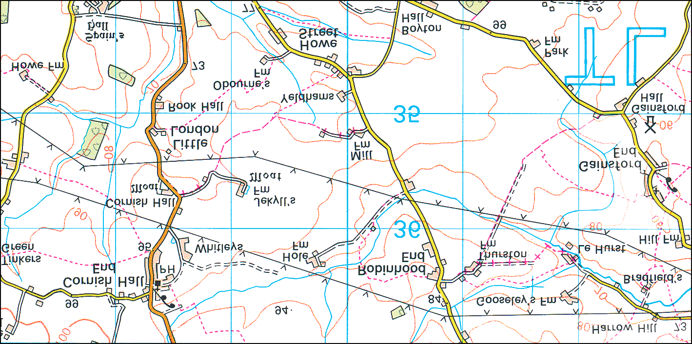
west corner, quote all the eastings first, 11Here is an extract from a 1:50 000
then the northings. The 100-metre grid scale map. Use the National Grid reference of the point in the diagram is reference system to find:
shown like this: TL 623317.
The Church at TL683365
The Windmill at TL726350
Mill Farm at TL701352
General enquiries: +44 (0)8456 05 05 05
Textphone: +44 (0)23 8079 2906 (Deaf and hard of hearing users only please) customerservices@ordnancesurvey.co.uk www.ordnancesurvey.co.uk Published by Ordnance Survey, Romsey Road, SOUTHAMPTON, SO16 4GU. Ordnance Survey, the OS Symbol, OS and Landranger are registered trademarks of Ordnance Survey, the national mapping agency of Great Britain.